| The Ridgecrest Area
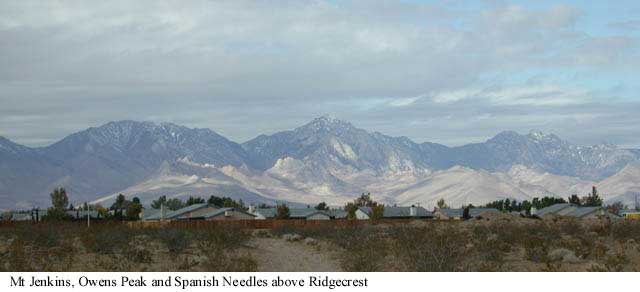
I choose to live in Ridgecrest because of it's proximity to some really good mountains (the Sierra Nevada) I endure hot arid summers with the help of air conditioned vehicles, a swimming pool and swamp coolers. I prefer hiking and camping in the mountains in the dead of winter over hiking and camping in the desert in the dead of summer, but the desert is a beautiful place to be out in from late October to early May. Here is a link to Desert USA which is a site that is geared to the desert surrounding Ridgecrest. I will try to digress from high alpine meadows and point out some of the desert features in the extended area. When you have to drive 85 to 100 miles just to find a large store other than the Wall Mart or K-Mart in Ridgecrest, we have no problem considering things 100 miles or more away to be in our area.
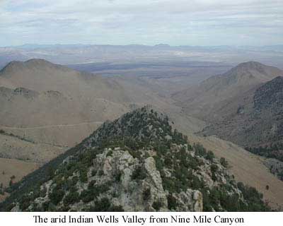
The Ridgecrest area offers most the modern conveniences, close to a wide open natural environment. For being a desert area you would be surprised how many springs and waterfalls are in the extended area, if you know where to look. There are also desert lakes in the area but they are small to intermittent and don't contain drinkable water. The closest major springs are the Indian Wells Springs which the valley is named after. Late in 1849 a group of people moving west split into two groups to try and find their way to California late in the season. One group became snow bound in the high pass north of Lake Tahoe which is now known as Donner Pass and were rescued only after having to resort to cannibalism to survive. The other group headed south and came through Death Valley. The first drinkable water they found after Death Valley was reputed to be at the Indian Wells Springs. Today there is the Indian Wells Restaurant and Indian Wells Brewery at the site of the old wells. There is still water which runs above ground year round above the wells in Indian Wells Canyon.
The fact that the Sierra has water in them,
even on the drier leeward side is no great surprise, but some of the other
sources of water are not easily locatable without local knowledge. About
30 miles to the east/northeast of Ridgecrest is Trona (named after a mineral
called trona). The only business in Trona is the hydro mining of the mostly
dry Searles Lake bed for potash, borax and many other salts and minerals.
The water that provides the town it's livelihood now comes through a set
of pipelines from the Sierra but once was provided by a pipeline from a
natural spring fed system called Great Falls Basin (Trona Falls). There
are actually six of the falls that interests me, those are the ones I (and
friends) have repelled down many times. The falls run most the year
depending on the sparse winter rains. Even when the falls are only a trickle,
recently there have been great pools that remain year round.
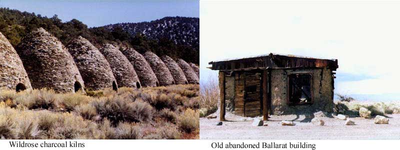
Beyond the Searles Valley lies the Panamint Valley which along with the Saline Valley to the north of it are the most isolated and least populated in the area. Charles Manson and several members of his "family" were captured hiding out in the remoteness of the Panamint Valley. The night skies are filled with the Milky Way and countless stars due to almost no light pollution. The few lights are provided by the semi ghost town of Ballarat, a few still working mines or quarries and the and the sporadic traffic going to and from Death Valley from Ridgecrest. On the west of the north/south running valley are the Argus Mountains with ~8000' Matarango Peak being the highest. On the east is the Panamint Range of which 11,049' Telescope Peak dominates.
Panamint in its very name expresses what the valley
and mountains were about, mining. Ballarat in it's hay day, around the turn of the century (19th
to 20th), was a busy supply point for the local mines. Trees above
the 7000' level on Telescope Peak were used to make charcoal to support
the valleys' mills and smelters. Surprise Canyon a little north of Ballarat
in the Panamints leads up to the site of the now deserted Panamint City
which was an operational mine until the 1980s when it had to be closed
because a flood washed out the lower road. Until this year (2001)
radical 4 wheel drivers could winch their way up the water falls in the
lower canyon and drive up to Panamint City. (BLM strikes again)
Newspapers
|