| Back to Mountaineer | |
| Mt Shasta 14,162' (Tied with Mt Sill for 5th highest in California)1986 | |
 |
|
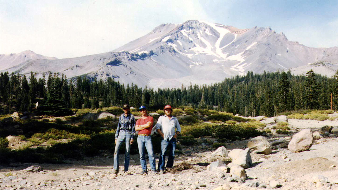
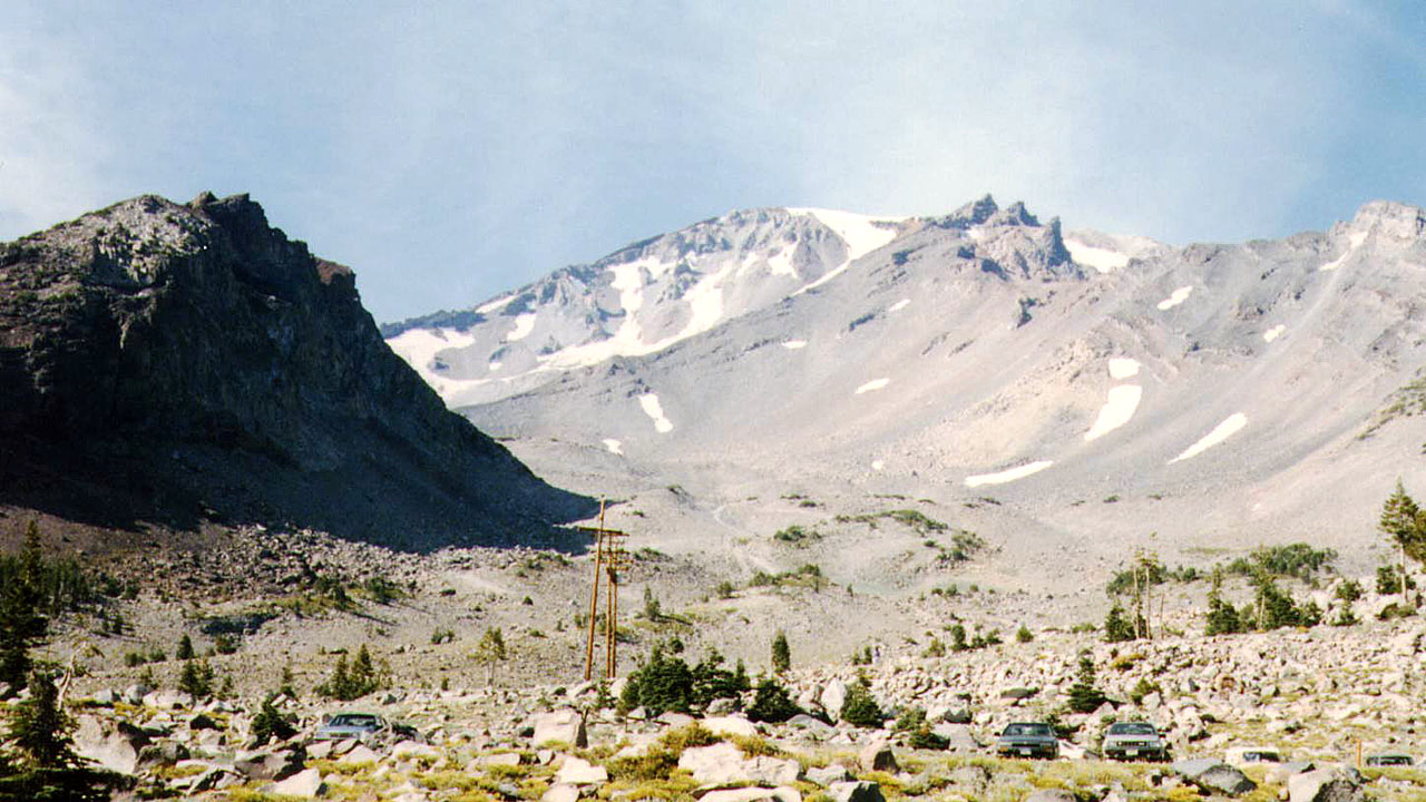
| Barry, Mike & Louie at Bunny Flats after the climb (The Heart & Red Bluffs in the upper drainage) | |
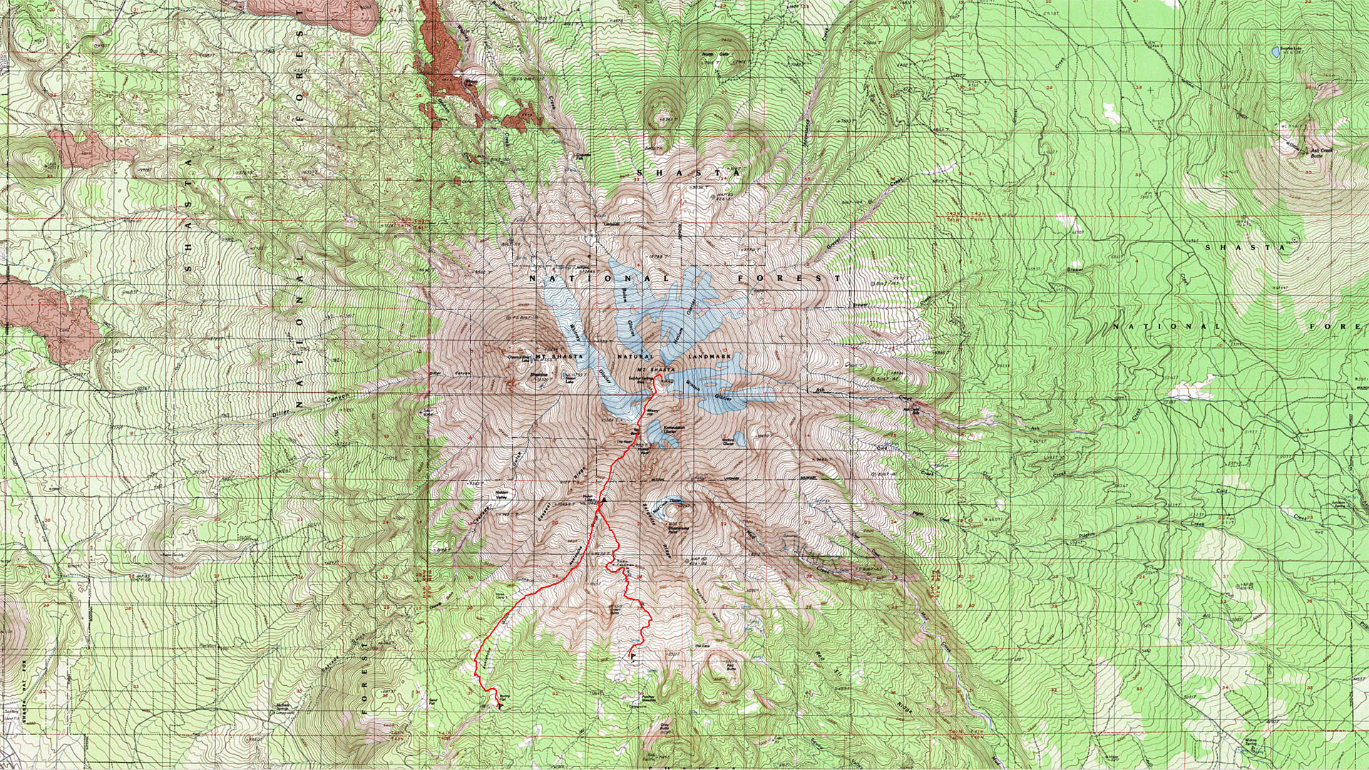
| Mt Shasta September
1986 Mike, Barry and myself decided to climb Mount Shasta which is about 250 miles north of Vallejo where Barry and I were living. (Mike was living in nearby Susiun). We managed to get pretty blitzed on the way and spent the night sleeping next to the road on the mountain. The next morning we went into town for breakfast, probably in Mount Shasta. The climb started with hangovers all around which doesn't bother me I'm used to climbing with one but it really slowed down Mike and Barry. We decided to start the climb from the old ski area which had been closed years before by avalanche. It turned out it would have been better to start from Bunny Flats where we ended upcoming out. We ended up having to climb over a ridge to get into the proper drainage. The ridge was volcanic scree which seemed to make the climb one step up and slide back down most of that one step. Besides that the scree was very abrasive on my new boots. After laboring over the ridge we dropped into Avalanche Gulch and made a camp in the rocks at around 10,000'. There was supposedly a small lake called Helen Lake in the area but we didn't see it . The next morning we joined the throngs heading up the heart towards the summit. The two snow chutes outlined a heart shaped rock area hence the name. Mike and I had crampons but Barry and most people didn't. Unfortunately this forced most of them onto the rocks which they dislodge with regularity. Someone would yell rock and you'd look up to see a rock careening down at you, which you had to avoid by any means possible. I felt like we were targets in a shooting gallery. When we reached the the top of the heart we were near thumb rock and the Konwakiton Glacier. It was the first glacier I had ever been close to and even though it was very small it was impressive. The ice cliffs and crevasses convinced me to stay off it. Above the heart was Red Banks where we found a gully to follow to the top. Above Red Banks we passed the head of the Whitney Glacier and followed along a relatively low pitched plateau towards the summit block. The area was covered with sun cups which slowed me down a little climbing in and out of them. Actually I couldn't get much slower, Mike finally pushed ahead on his own. Just about everybody passed me except for a woman who was climbing with her son. She had a bad case of altitude sickness and was stopping frequently to dry heave. I was worried about her, I had a headache and slight dizziness but hadn't reached the third stage which is vomiting. She could have gone into the final stages which can be pulmonary or cerebral edema. At that point the only thing to do is to head back down or die. After reaching the top of the Whitney Glacier the view was getting good with Mount Shastina rising from one side of the glacier and Mount Shasta on the other. Shasta is almost a perfect volcanic cone except for 12,330' Shastina. The map shows a spring near the summit but it's a good thing I didn't need water because it is a sulfurous hot spring. From the spring the route climbs steeper to the summit where Mike had been waiting for me for hours. Barry had turned back somewhere around Red Banks. Most the people had summited and headed down by the time I got there but there was still someone left to take our picture on top, he was waiting for his mother. There had probably been over a hundred people on top that day and I was second from the last. To her credit the guys mom showed up while we were there, and I though I had tenacity. We headed down and when we got to the snow chute by the heart we came across a fast way down. So many people had slid down on their butts that they had formed a trough that was hardening as the sun set. I was like a bob sled run or half pipe with the walls about armpit height while sitting. Ice axes came in handy for braking to reduce speed occasionally and we screamed down hundreds of feet in elevation in minutes. We found Barry back in camp as light was fading and spent the night the same place we had spent it the night before. One thing I learned on Shasta was if their is water running through the snow areas in the evening you had better fill up if you needed some because it wont be running in the morning. The next morning we hiked down Avalanche Gulch and out Bunny Flats. That's about all I recall thinking back on the trip in April of 2004. |
|
 |
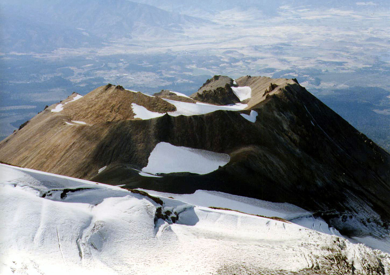 |
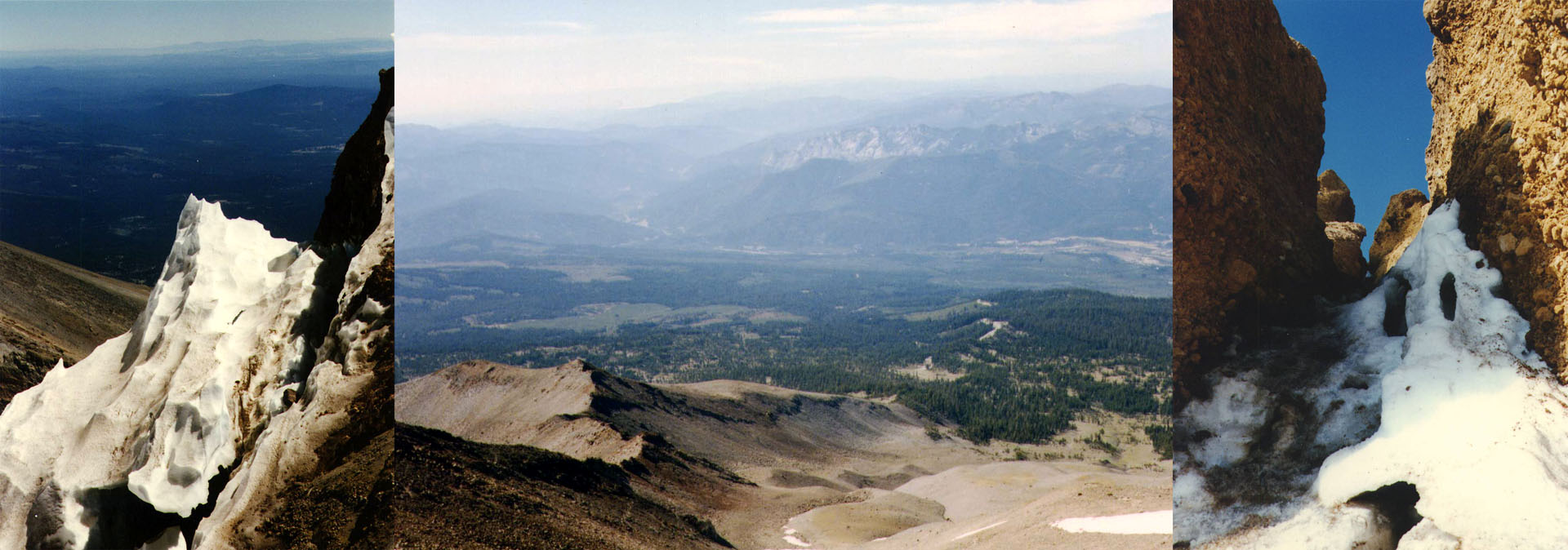
| Top of the Whitney Glacier and Mt Shastina | |
 |
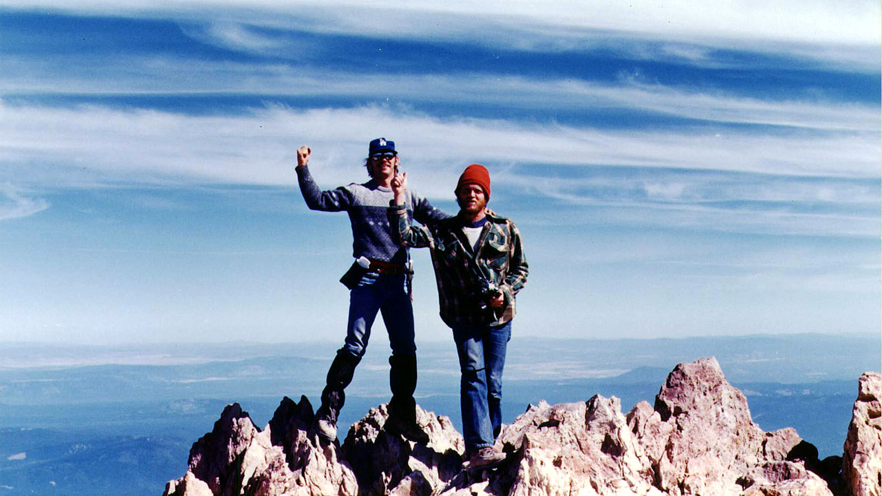 |
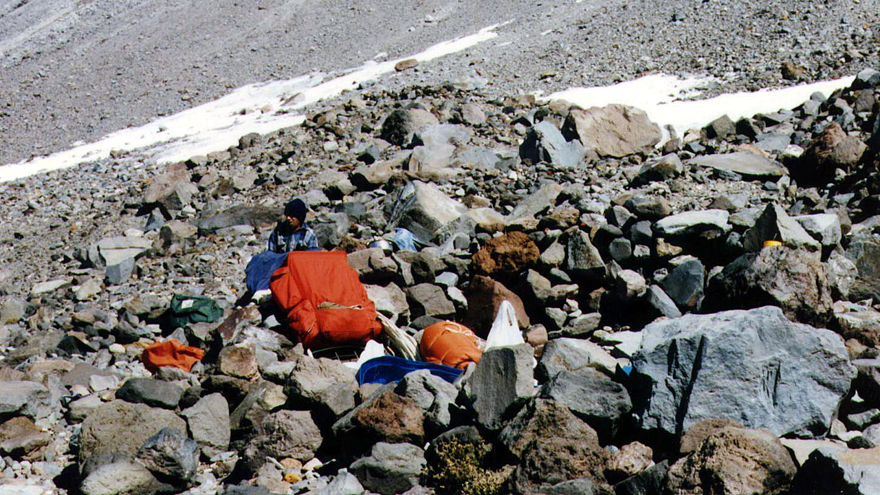
| Barry at high camp | Mike & Lou on summit |
 |
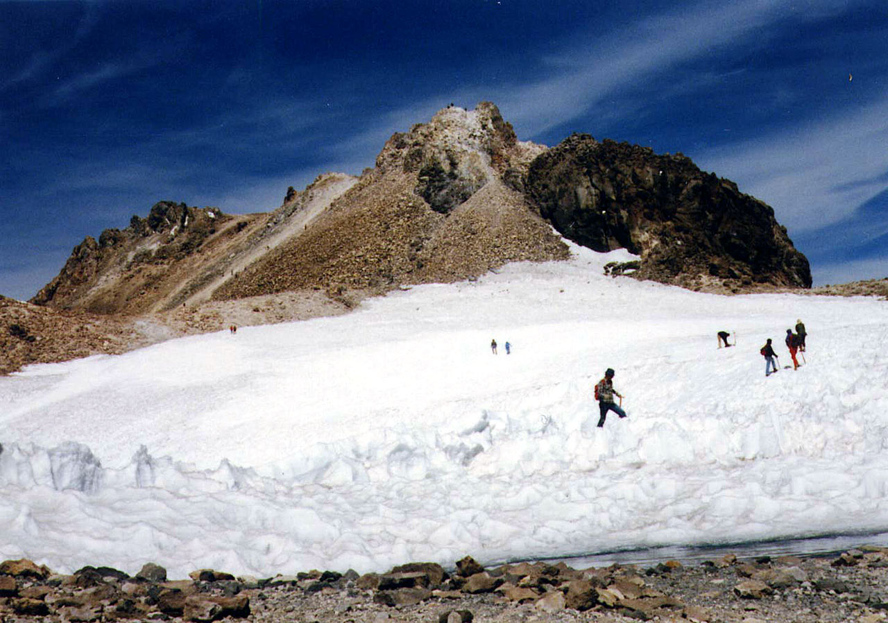 |
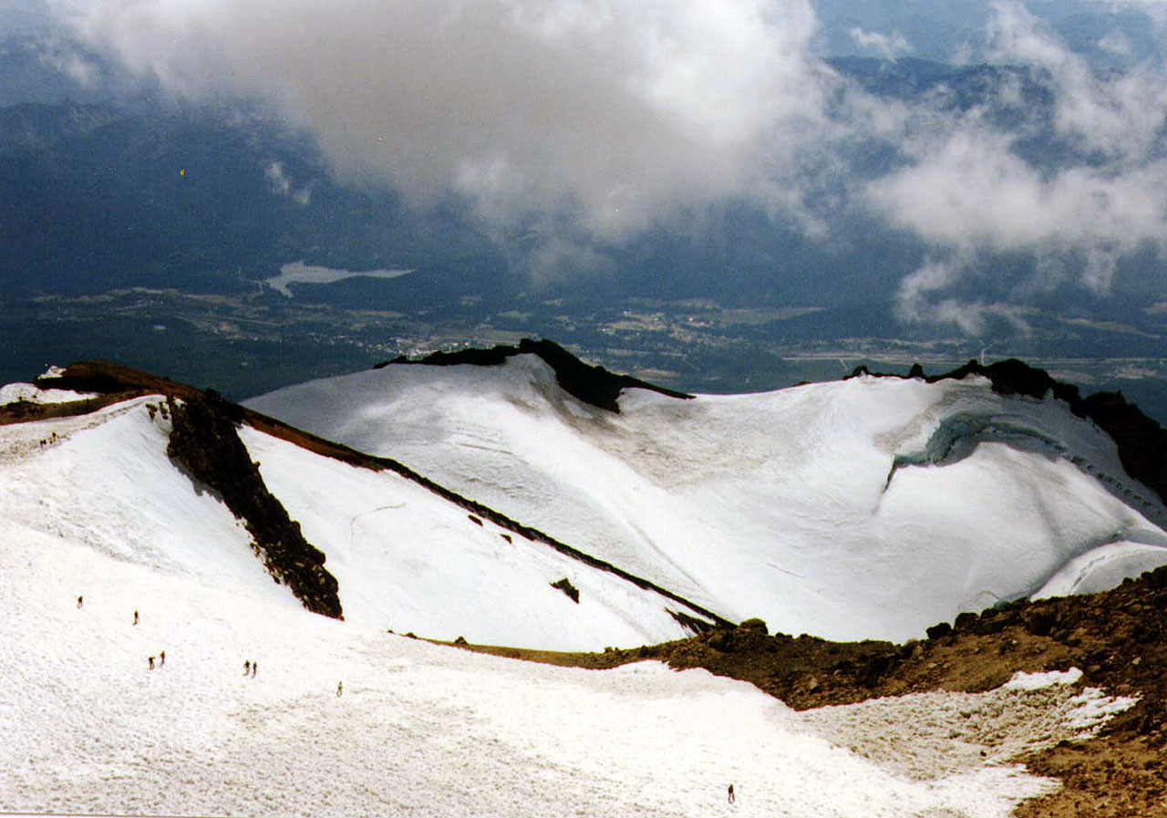
| Some of the crowd above the Whitney Glacier | Crowd headed for the summit block |
 |
 |
| Green Butte on the left from starting point | Hot Sulphur Spring near summit |
 |
|
| Corner of Konwakitan Glacier View out towards Castle Crags Our route through Red Banks | |
| Map | |
 |
|
| Back to Mountaineer | |