| Back to map to Map Back to Palisades Back to Mountaineer | |
| Mount Sill | |
| 14,162' (4317m) Tied with Mount Shasta for 5th highest in California 1999 summit | |
 |
|
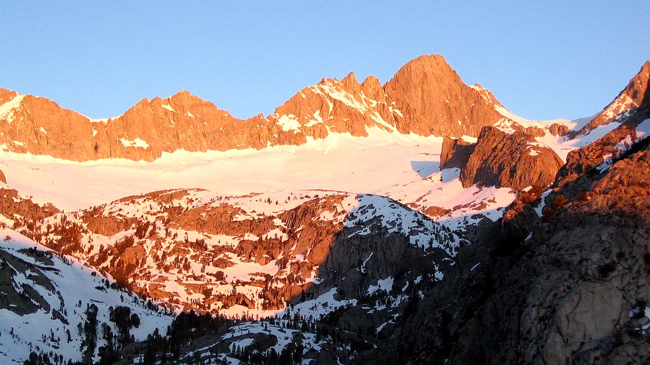
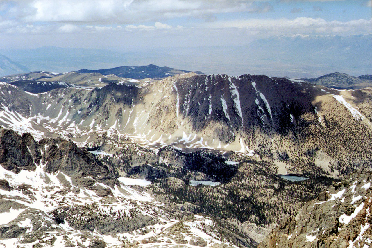
| Sunrise on Mt Sill from above Willow Lake, South Fork Big Pine Creek. | |
 |
 |
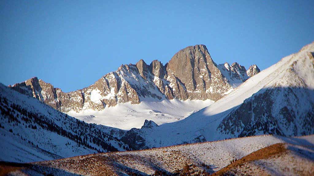
| Mt Sill from US395 (telephoto) | Mt Sill from North Palisade summit (Randy Ray in foreground) 1994 |
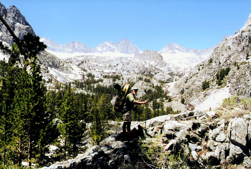
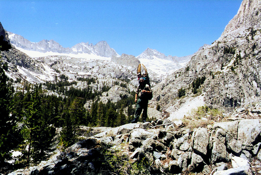
| Mt Sill took me 5 attempts. Memorial Day
weekend 1995-99 1995 North Fork Big Pine Creek from First Lake with Mike & Randy. 1995 year after N Pal 1996 South Fork Big Pine Creek with Mike & Randy. (we didn't make a summit attempt.) 1997 South Fork Big Pine Creek (Randy quit climbing (forever) 1997 or 98?) 1998 South Fork Big Pine Creek 1999 South Fork Big Pine Creek with Mike (made the summit) |
|
|
|
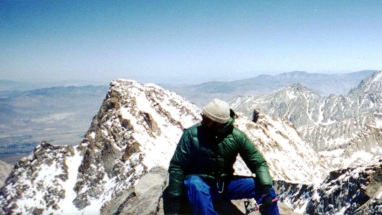
| 1999 light snow conditions starting off (Randy's Ridge is in the middle of the picture) | 1999 summit view towards the Northwest |
|
|
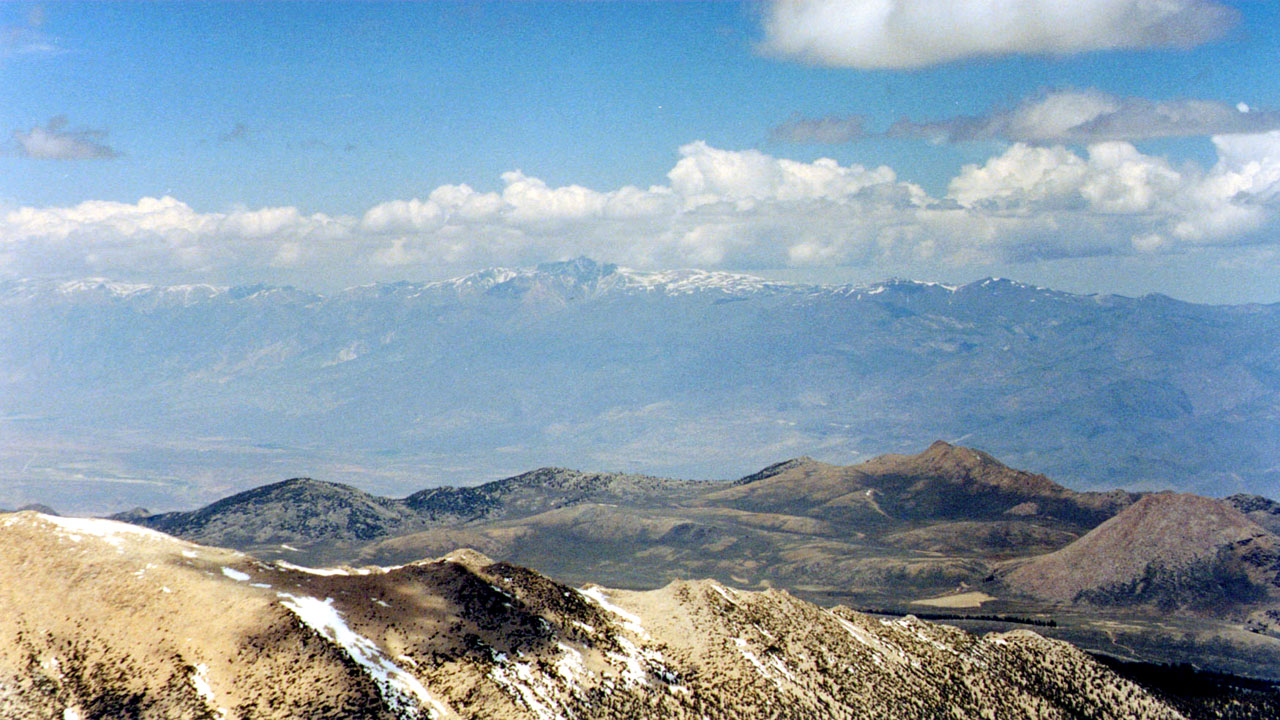
| White Mountain from Sill summit 1999 (Coyote Flats mid ground) | |
|
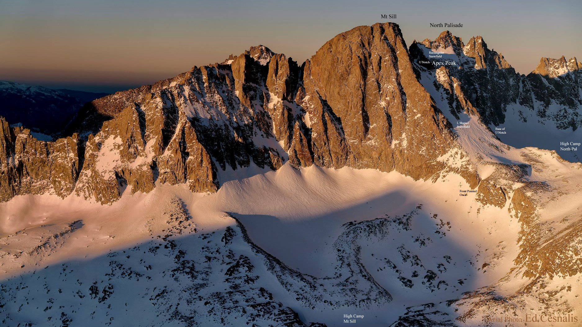
Since we weren't good enough to do the Swiss Arête route (Mike's daughter in law Marian had done it but she was a strong rock climber) we always tried for the col between Sill and Apex Peaks above the L shaped snowfield. They claim it is a class 4 but we always balked when looking at it because of the extreme exposure. (It was our turn back point on attempts 3 & 4) The 5th and final time in 1999 we carried climbing gear and roped up to get across the exposed stretch. On the way back down we left an anchor on the mountain. Two guys who had done the Swiss Arête route, brought our anchor back to us when they came down via the col route. They admitted they hadn't felt comfortable with the exposure without protection because of the snow and ice. |
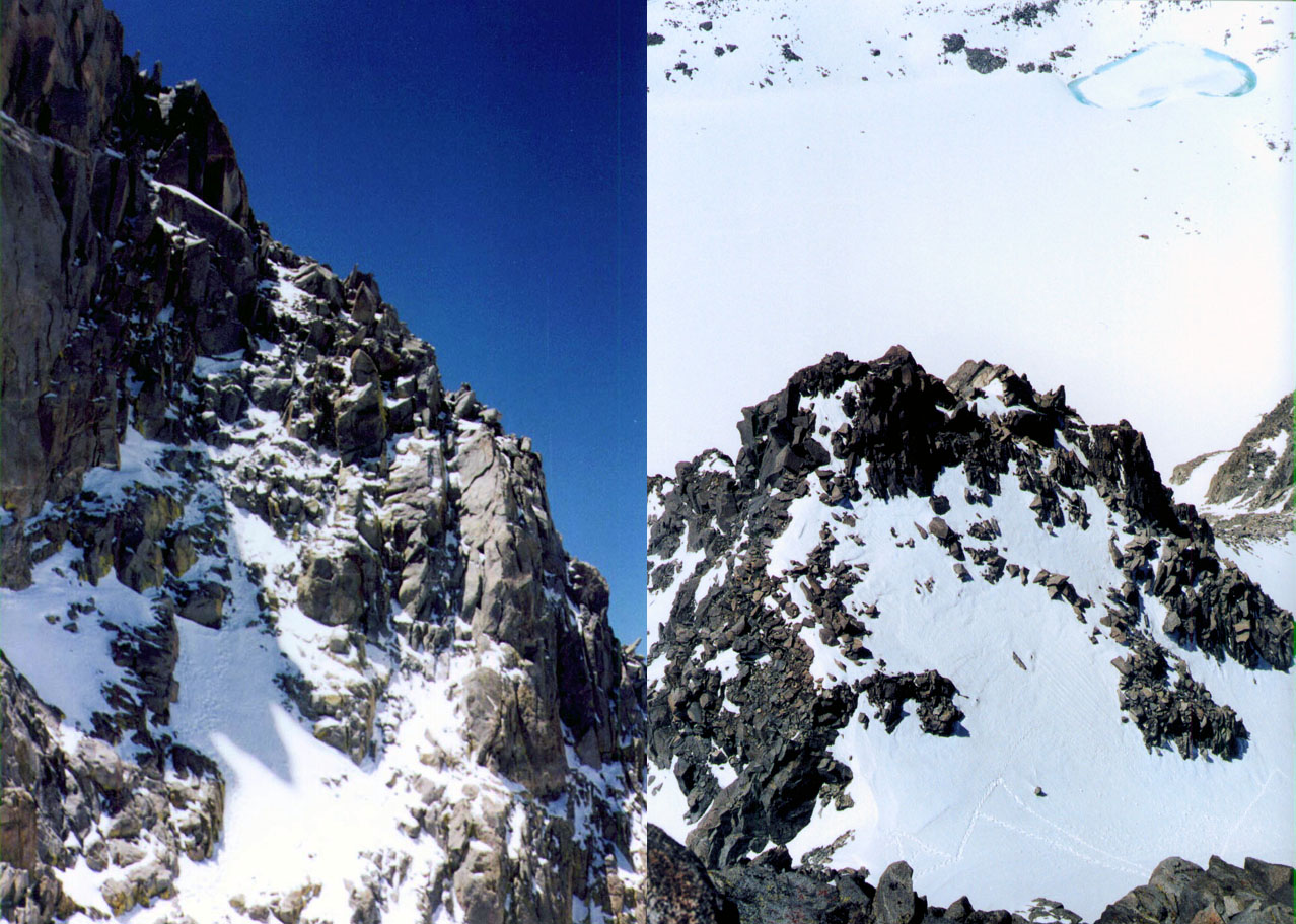
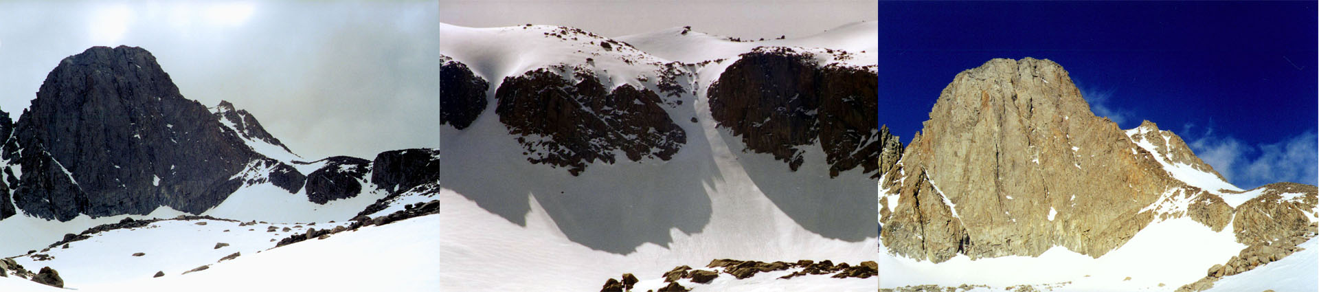
| The crux of the climb from the col Looking back down at Apex Peak | |
| 1995 Notes: Mt Sill 14,153' (6th highest in California) Memorial Day Weekend 1995 Friday 7.5 hrs Glacier Lodge to Second Lake ~10,200' Saturday 9.5 hrs Second Lake to High Camp overlooking the glacier near the side of Mt Gayley ~12,400' Sunday 6.5 hrs Summit attempt turned back at ~13,800' (ice and snow on rock) reached point even with Apex Peak Monday 5.5 hrs High Camp to Glacier Lodge ~8,000' |
1996 Notes: Thursday 5/21/96 1 picture of beer at Jake's Saloon in Lone Pine and 16 out of 21 beers from the camper. In bed around 00:30 and up around 07:15 Friday Leave Glacier Lodge trailhead around 09:45, cross south fork at about 11:15, arrived above Willow Lake around 16:30. Bed around 20:15, 03:00 Randy comes in the tent to get away from the snow. Saturday Up and about around 07:30, still snowing lightly, only a dusting of 1" or less of dry little balls. 09:45 departed on day hike, at ~ noon Mike and Randy split off near the cutoff for Lake Elenor to climb the rock ridge I continued on the snow route towards Sill. ~14:00 Mike and Randy slid down chute and went back to camp. Reached the top of the left tit on the ridge above Elenor (as viewed from camp) at 16:00. Departed ridge at 16:30 and arrived back in camp around 18:30. Sunday Departed camp at 8:45 and arrived at the trailhead at 11:15 |
|
|
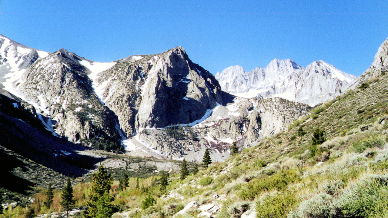
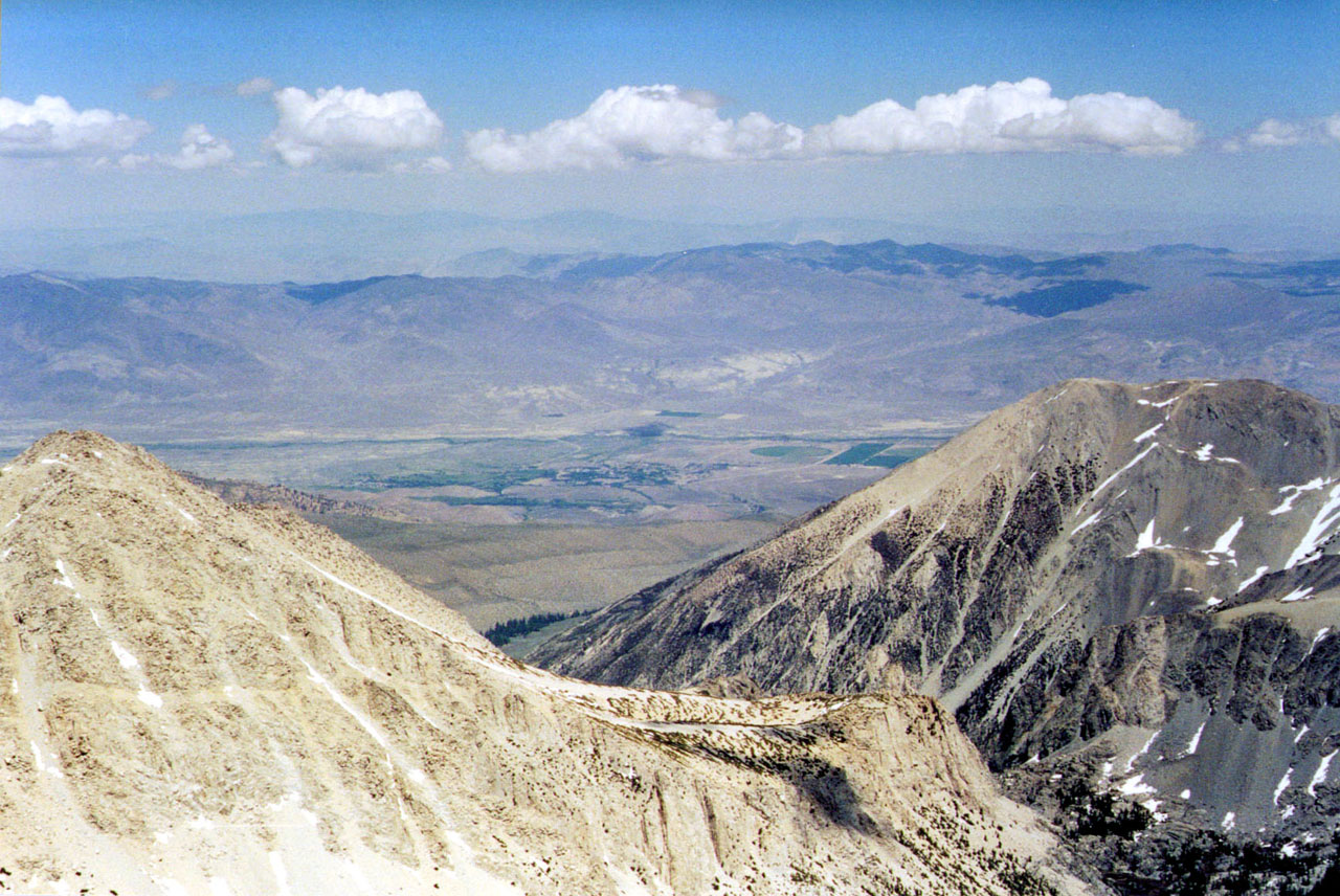
| North Fork Big Pine Creek 1999 | Out into the Owens Valley to Big Pine |
| 1997 Notes: MT SILL 5/22/97 Thursday... Went home from work 1 1/2 hr early with diarrhea, vomiting and a low fever around 101. Slept for about 3 hours and managed some packing. Finished packing Friday morning. Friday... On trail 09:05. Break on the other side of the south fork at 10:20. Crested the pass to Willow Lake at 14:00. Wasted about an hour from the creek on breaks. 14:45 - 15:30 or so, hung around near Willow Lake. Snow squalls since we reached the pass. Moved up the creek until we ran into a narrow band of snow pinched between a rock wall an the creek, turned back several hundred yards and started setting up camp at 16:30. 17:00 40 degrees, snow flurries, heavy wind which are mostly blocked by the trees. Saturday... Froze over night and left a little trace of snow here and there, especially around the tent. Mike up at 06:00 me around 06:45. Started up the creek at 8:42. Reached the cut off for Lake Ellenor at 10:50. 16:40 at about 12'600 setting up camp in the rocks, temperature around 35 degrees in the shade, the last couple of hours have been a bitch, overcast, snow flurries, windy and cold as hell. A few hours latter the sky cleared and the high ridge became mostly visible. Sunday... Up around 06:00, Clear cold and windy. Departed at 6:45, Glacier gap was very windy and cold, got a little better towards the col which we reached at 10:45. 4 guys were trying for the summit, 1 turned back and joined us and his friend on Apex Peak 12:05. Departed col for camp, didn't go back down the chute we had come up because it was so steep, instead down climbed some rocks past the chute towards Gayley. 1:55 back in high camp. 3:15 left high camp, did some good butt sliding, ass got wet because the gortex leaks. New camp 5:10, snow sliding still takes muscles and is tiring but more than twice as fast as the 4 hours it would have probably taken to walk. Sewed broken back pack strap, seems to be many loud frogs in the pond near camp. Sun went behind the ridge between Gayley and Castle Crags a little after 18:30. (much nearer to Gayley). Mike one a game of cribbage, I won the first to nights counting beating him the second night because of mugging 4 points. Monday.. Left camp at 08:45, retrieved sneakers and found water bottles without having to do snow pinched off snow field. Down to final stream crossing at 11:20. 11:30 to 12:05 to get to Glacier Lodge trailhead. Need permits to prevent overcrowding?, not this time of year, we saw 14 people in the 4 days. 2 couples, one on the way in to fish (don't know if they ever made Willow Lake) one coming in with a dog on our way out. 2 people from a distance on the way down from high camp whom seemed to skirt off into the trees. 5 people at the col from the other side of the notch and 3 younglings who had a camp near Willow Lake. (saw them several times including up by high camp when the came by on their way to climb Gayley) about 64 degrees at trailhead at noon. Home thru LA traffic around 14:30. |
|
|
|
| Sill & Apex peaks from 1999 high camp Snow Chute to L shaped snowfield climbed in 1997 (1999 picture) Sill & Apex peaks from 1999 high camp | |
| 1998 - It was either in 1997 or 1998 that I carried a movie camera with me. It was Randy's last back packing trip. We we were working our way up the first big ridge out of the Glacier Lodge area. (Glacier Lodge burned down in 1998). It was deep snow and were were post holing pretty bad. Randy was bitching and as a joke I told him to put his snow shoes on. He did and ended up sliding down the ridge which was way too steep for snowshoes. He had enough and somewhere I have video of him trucking off towards Glacier Lodge. He managed to call his wife Kelly to come and get him. I never got him out back packing or camping again. After that I called that first big ridge Randy's Ridge. He did repel Great Falls Basin (Trona Falls) with Mike and I after that in 1999. Unfortunately Randy died of cancer in 2013 at age 56. | |
|
|
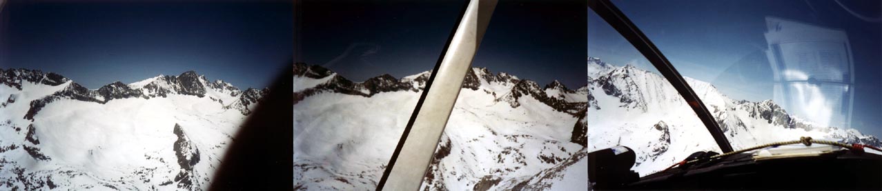
| Randy had a relative with a small plane, they flew over the Mt Sill area in 1998 | |
|
|
| Myself & Mike above Willow Lake heading for a high camp (photos courtesy M Stanwood) | |
|
|
| Mike & I on summit of Mt Sill (photo courtesy M Stanwood) | High Camp (photo courtesy M Stanwood) |
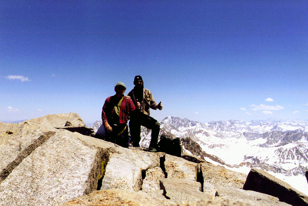
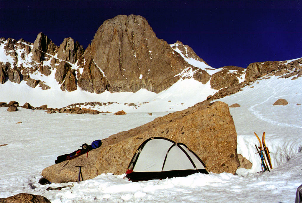
| 1999 Somewhere I’ve heard that the third times a charm. How about the fifth time? That’s how many attempts we made on Mt. Sill before we reached the summit. In our defense there was only one time when we reached the crux of the climb with the proper equipment at hand. On our first attempt there had been a recent storm and the rocks were very icy, combined with the fact we had no idea of the route. The second attempt we never moved up from base camp because of the weather, which ended up clearing. The third time we reached the col between Apex and Sill but I was unwilling to press on without protection. The forth time we reached the col again but I had left some of my gear at high camp. Finally on the 1999 Memorial Day weekend we negotiated the crux with two rope pitches and scrambled to the summit. Everything I’ve read about the route up Glacier Notch and the L shaped snow field claims the section from the col is a class 4 scramble. This may be true in the summer but with the spring ice and snow there is a danger which I refuse to face without protection, especially when nobody has punched a route across yet. A slip or a small avalanche could cause you to fall from the very exposed ledge to an almost certain death. You would probably come to rest thousands of feet below after your body went off a cliff and down a steep snow chute. I was surprised that after the crux there was still a bit of time and work left to do to climb to the top, but the exposure was minimal or non existent while working up through the large rocks the comprise the summit block. Sill is touted as having one of the best views in the Sierra and having climbed several other good view Sierra peaks I agree. White Mountain across the Owen’s Valley possibly offers a better view of the eastern escarpment of the Sierra but you don’t get to see across the range to the western side. One thing that stood out looking west was the huge canyon of the middle fork of the King’s River, mostly because of the lack of snow which characterized most the view of the high Sierra. Several nearby peaks looked higher but that was an illusion. There are only three higher peaks in the Sierra, the nearby North Palisades and the distant Mt. Williamson and Mt. Whitney which were all in view. Of the six highest mountains in California the only one not visible was Mt. Shasta in northern California. I was especially pleased with the summit of Sill because it meant I had climbed the six highest mountains in California. As was the case in three of the four previous attempts we had opted for the South Fork of Big Pine Creek instead of the more heavily traveled north fork. Both routes come together at Glacier Notch but the south fork is a slightly shorter route. We saw nobody for almost four days except for three climbers who climbed the more technical Swiss Arête route. They had came up from and returned to the north side of the notch. I have never seen a ranger in the south fork basin on Memorial Day weekend, where on the other hand I have met one at high camp on the north fork route. I believe a Wilderness Permit is an oxymoron issued by a moron. Originally we were told by the government that permits were just to indicate usage for funding purposes. Latter we have been told they are to prevent over usage and over crowding. Although there was a posted warning about be cited and escorted from the wilderness if you are found without a permit there is no reason for one on the south fork that early in the year. On the five attempts we tried to get a permit from the local campground host at the Glacier Lodge campground the first time when we took the north fork route. We were told he only issued them between certain hours and we were half an hour late. Needless to say we went five for five without a permit on Sill. 1999 was the lightest snow depth for Memorial Day weekend we had seen in six years in the Palisades area of the Sierra. (1994 was a climb of North Palisades, 1995-1999 Sill). Snows in the southern Sierra had been late and overall light. From Mammoth on north the snows had been heavier with even above average snows up around Lake Tahoe. The snow was melting fast and there was a good run off occurring in the Big Pine drainage. The trail from Glacier Lodge to Willow Lake was almost completely exposed and easy to follow. Unfortunately where there is no obvious trail above Willow Lake and jumping between boulders with a 65 pound pack is not as easy as crossing snow fields if they are firm. The going was slow until we finally reached the mostly unbroken snow. Even then areas where we had slid down the mountain on smooth snow the year before were cluttered with rocks poking out from the snow until we climbed above the ten or eleven thousand foot level. There were even small grassy meadows starting to appear in the snow fields that had been many feet under snow the previous years. The late afternoon snow was very soft as we neared our days end. We downed snow shoes for the final trudge to a camp protected from the mountain by a large boulder. We built a packed flattened snow area and pitched my tent in the wind shadow of the boulder as I claimed a nearby island of rocks to spread my possessions out on. I gathered in the vistas until deep dusk sent me into the tent to try and conserve body heat. I ate lightly and retired early after playing Mike a usual game of cribbage. I set my resolve that I would make the summit the next day, there would be no turning back. The next morning dawned mostly clear except for a disturbing cloud covering the summit. I knew we were going to summit but I didn’t know if we were going to have a view. We chose to climb the rocks above the small bergshrund rather than do the steep snow chute which had bothered me on one of our previous attempts. I seemed a little more difficult than it had been the previous year but then again my memory fades from year to year. (The bergschrund is the crevasse at the top of the glacier where the snow mass is trying to pull away from the rock wall which the glacier hangs from.). Once above the broken rock wall we made our way up Glacier Notch to the base of L shaped snow field and the steep chute which led to the col between the 13,800 foot Apex Peak and the 14,153 foot Mount Sill. As steep as the chute was once you reached the col there was a chute on the other side just as steep. Above us three climbers disappeared into the clouds as they made their way towards the Swiss Arete , which is a rocky ridge to the summit which was a more technical climb than we were planning on. The clouds on the mountain top were lowering and I was dubious of the summit view. The chute was slow going, punching steps in the fairly soft snow to form switch backs up to the col. The crampons were not really needed but offered added assurances. A fall wouldn’t be fatal but it would negate a lot of work and postpone the summit. SEEMS THIS IS ALL I COULD FIND WRITTEN AROUND 1999, it doesn't include from the col to the summit and down. |
|
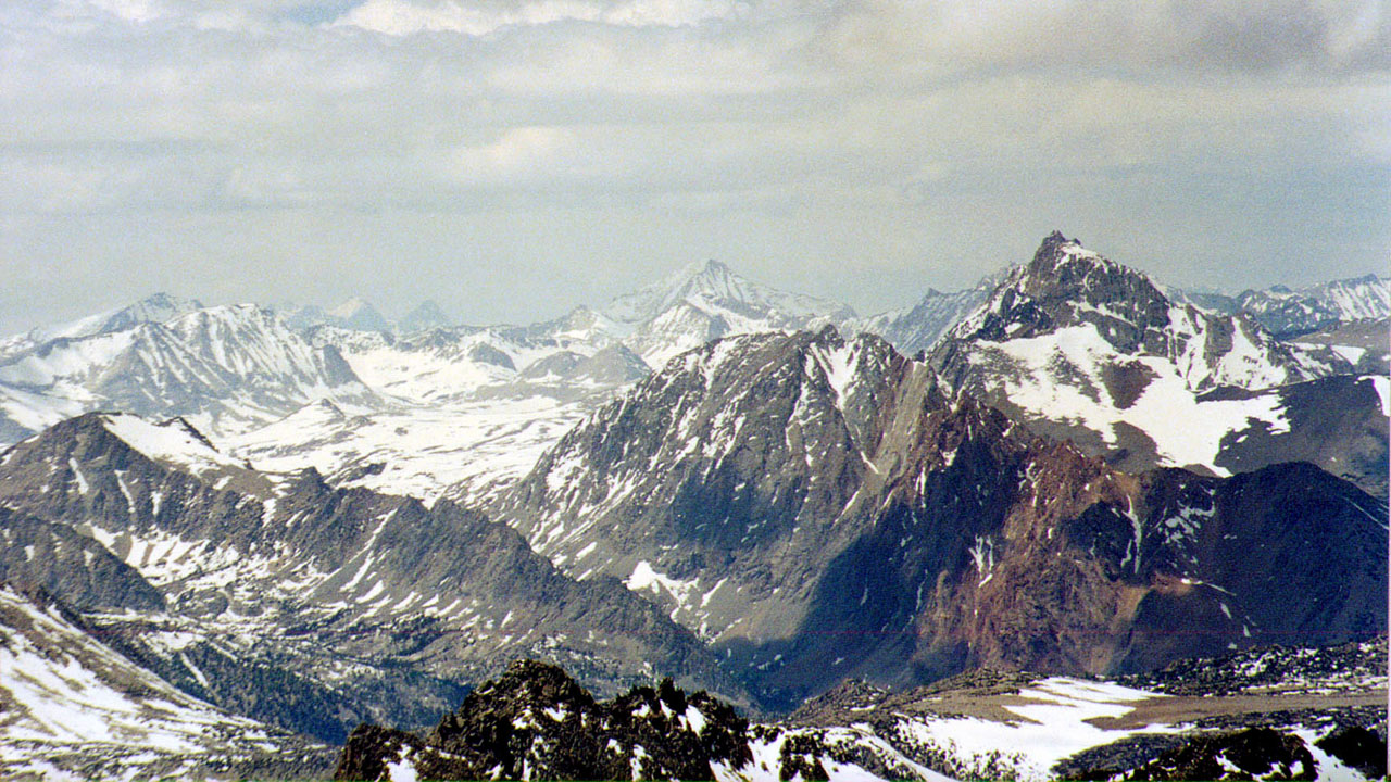
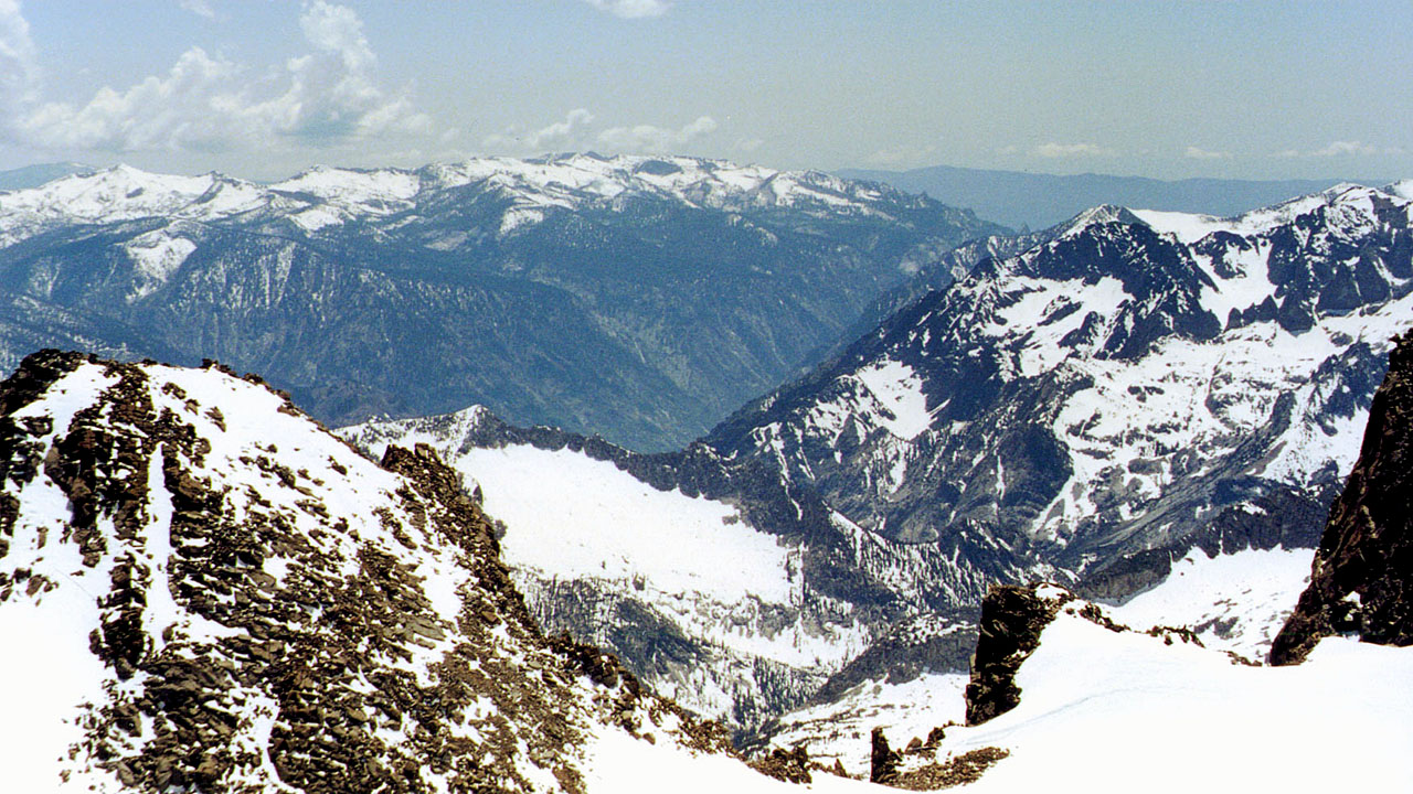
| Panorama from Mount Sill Summit (page 1) (page 2) | |
|
|
| Ed has a sport plane out of Mammoth and does aerial photography. (https://www.edcesnalis.com/) | |
| Back to map to Map Back to Palisades Back to Mountaineer | |