| Back to map
to Map Back
to Mountaineer Back to Palisades |
| Middle Palisade |
| 14012' (4270m)
11th highest in California 2007 Summit |
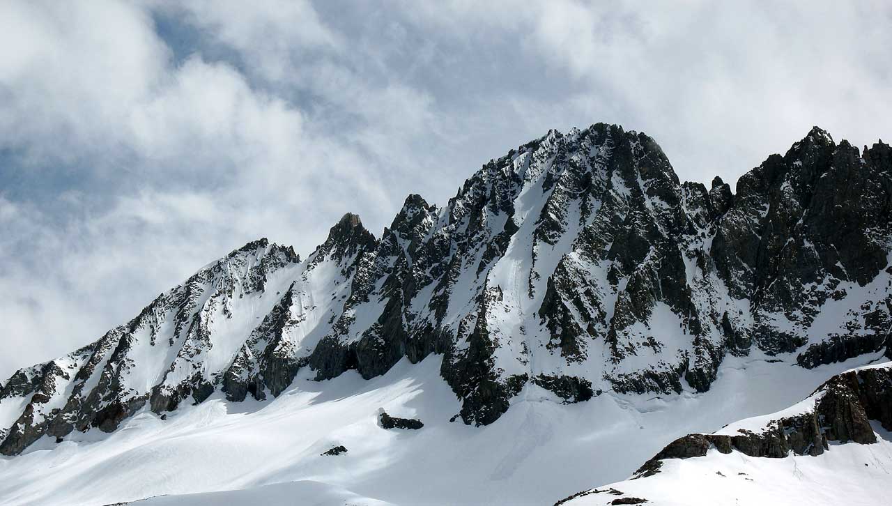 |
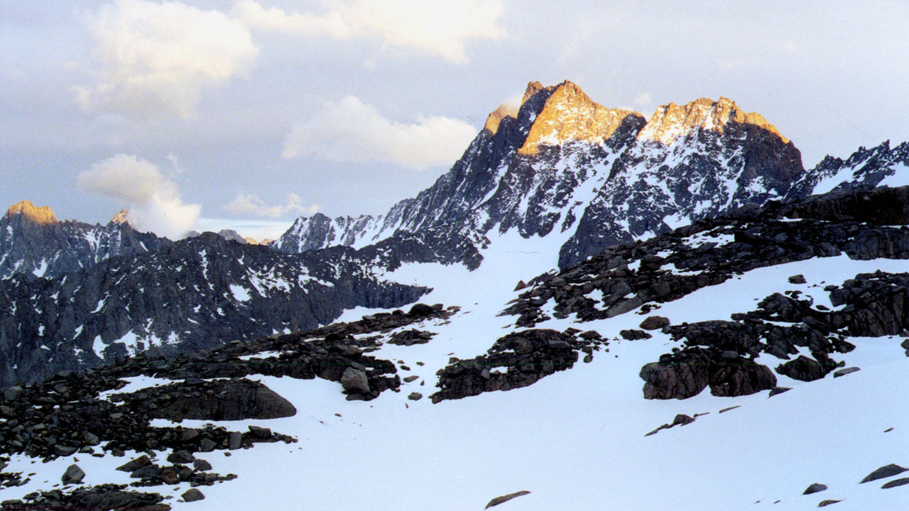
| Middle Palisade from North Big Pine Creek
drainage |
 |
 |
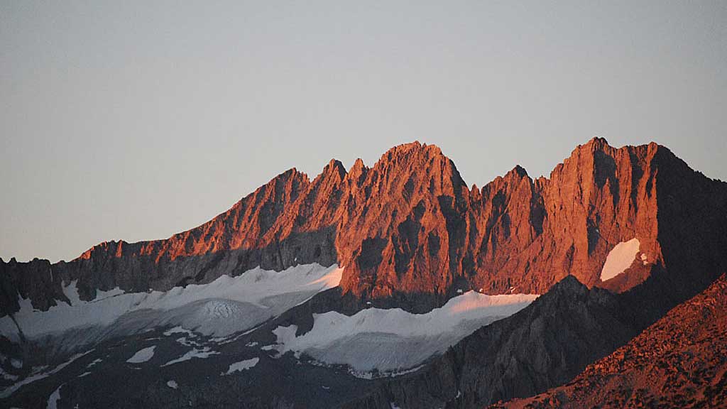
| Middle Palisade area from Coyote Flats (Sierra) |
Middle Palisade area from Papoose Flats (Inyos) |
|
May 26th 2007
After 56 years of life, between 1/4 and 1/2 million
cigarettes and cigars and well over 100,000 beers it was time to attempt to kill myself again. I had screwed around with
Middle Palisade (12th highest peak in California) for the previous three years.
Three years ago Mike and I had turned back from above Willow Lake because of various
personal and gear problems. Two years ago I had been alone above Willow Lake and
had day hiked to the ridge above Brainerd Lake which overlooked Finger Lake.
Last year Mike and I camped above Willow Lake in winds sustained well over 60
mph and gusting over 100. We turned back the next day to find that some climbers
who had attempted the summit had turned back because of recent unconsolidated
snow. (hard to get through and an avalanche danger on the steep upper slopes) In
actuality this would be the first time we put up a high camp and made an actual
attempt. I just like the South Fork because you can go days without seeing
anybody, as opposed to the North Fork which is crowded.
In an attempt to quit smoking cigars and acclimate to the
altitude I left Ridgecrest three days before Mike. I spent Monday night at Oak
Creek campground outside of Independence. Tuesday I continued up to trailhead
parking at Glacier Lodge on Big Pine Creek out of Big Pine. (Actually Glacier
Lodge burned down years ago) Trailhead parking is a ways (1/2 to 3/4 mile maybe?) from
the trailhead for the South Fork of Big Pine Creek but I didn't bother dropping
my pack off and then parking because I was more interested in whether or not my
large camper would fit in the parking lot. (Somebody stole my Jeep from the
Barstow Amtrak station while I was in New York in April (Grandmother's 100th
Birthday) and had to drive my 7 mpg camper 135 miles each way for the climb).
I was on the trail by 10 am and made camp above Willow Lake seven hours
latter. The trail crosses a bridge over the North Fork of Big Pine Creek almost
immediately and crosses the South Fork a hour or so latter (My being slow
probably closer to two hours). After crossing the creek the trail goes up a
steep ridge in nine switch backs. Having been the route on seven previous
Memorial Day Weekends it was strange to actually take all the switch backs.
Usually there is considerable snow covering the trail and you just kick step up
the snow. A clear trail with switchbacks is actually easier. I usually carry a
60 to 70 pound pack and the 50 pounds I was carrying made it a breeze. I was
planning on staying high and turning the corner south towards the thumb instead
of going up towards Brainerd Lake but there was no snow and scrambling boulders
with a full back is a pain. Instead I stayed on the trail past the Willow
Lake-Brainerd Lake sign and made camp.
The second day I took the stream towards the thumb aiming for
a small un named lake above and south of Brainerd. ( It was the route I had
given Mike and the lake was where I told him we would meet). The route without
snow became tedious so I back tracked a little and did a transverse of the
south side of the stream leaving Brainerd until I made camp at the lake. It was
a short four hour day. Thursday starting at about 07:30 I tried to follow the
trail from Brainerd back down towards Willow but lost it and ended up scrambling
down to where I had camped the first night. I wanted to run into Mike and tell
him not to take the route I had drawn on a map. I finally ran into him on the
trailhead side of the South Creek crossing and he told me he had left the trailhead
an hour before. I continued down to the camper, had lunch, grabbed a few odds
and ends and headed back towards Brainerd. This time I pretty much managed to
follow the trail from Willow to Brainerd. I ran into Mike about a 1/4 mile short
of Brainerd where he and I had both lost the trail. We bushwhacked for a while
then finally made it to my camp. The day hike had taken me a little over 9 hours
and Mike had taken about 7 1/2 to get there with a 65 pound pack.
|
 |
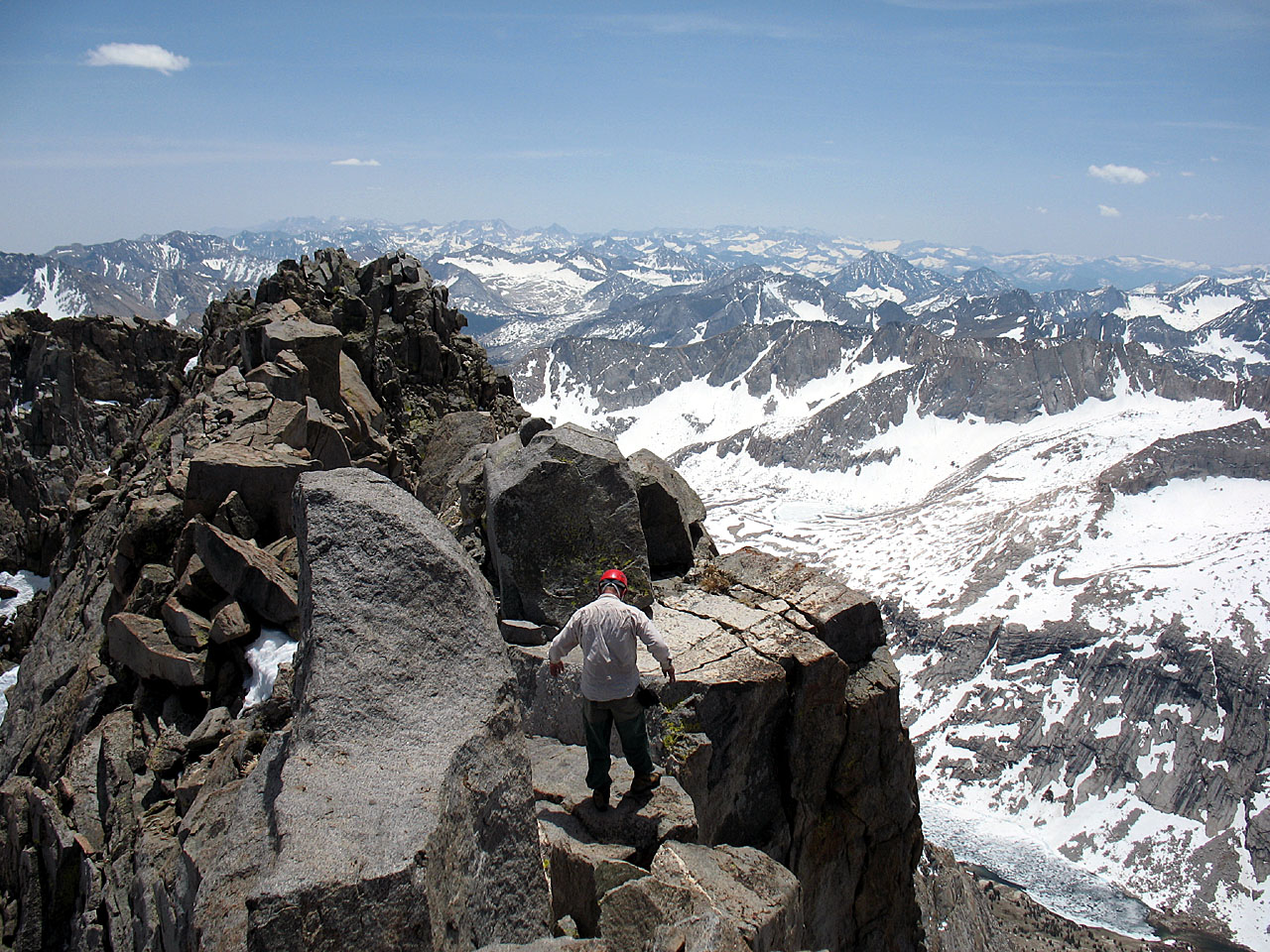 |
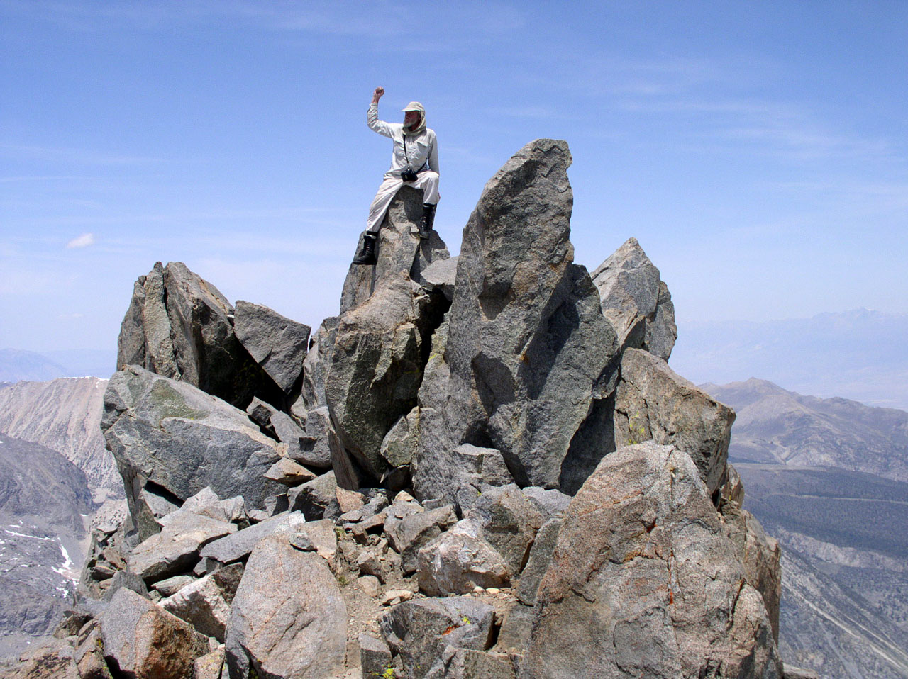
| Lou on Summit of Middle Palisade |
Mike on Summit
block (20' wide
doesn't seem small until you're looking down thousands of feet on each side) |
|
Friday morning we followed a stream out the south side of the
steep bowl Brainerd Lake sits in. We spotted the lake I had planned on passing
south of but for some dumb reason I decided to climb the ridge overlooking
Finger Lake to the north of it. When we gained the ridge top we had to transverse
south on it until we were across from the route up Middle Palisade. We made camp
in the rocks after about a six hour day. We ended up melting snow for water
because the light trickles of the rock slopes were insignificant We melted
enough for dinner that night and the climb in the morning. There were two mostly
frozen lakes a few hundred feet below us but we didn't feel like the exercise.
Water that is open or flowing in the evening usually isn't in the morning, but
during the trip it there was only a light freeze at night. (doubt the temps ever
got below the mid to upper 20s (F)).
Saturday morning we strapped on crampons, grabbed ice axes
and set off down hill a couple hundred feet to one of the frozen lakes. From
there on it was all up hill to the summit. About half the climb was up the
Middle Palisade Glacier and the other half up the chute that is the easiest
route to the summit. Mike comes in real handy, he researches routes and pretty
much know what to do to get to the summit. Me I just go for it, what did Norman
Clyde and other first time climbers due for route descriptions? Heck I had
finally figured out that what I thought was Middle Palisade was Norman Clyde and
which chute was supposedly the class 3 route to Middle Palisades summit. I
didn't know if the summit was left or right at the top of the chute or where to
get on it from the glacier. I would have probably tried to get on at the bottom
of the chute where the avalanche snow had built a big cone with a deep
bergschrund crevasse across it. Mike had us get on higher up, where there was a
huge spire we climbed past on the south before entering the main chute. The
chute was steep with occasional snow fields which we tried to avoid because they
weren't very deep or stable. For a supposed class 3 route we made a lot of class
4 moves.
Mike reached the top of the knife edge first and when he
looked through a crack between the rocks saw nothing but air. We then moved left
up to the summit block. At first we were unable to get up higher because there
was a move that would have been easier if there had been more snow piled up
against a large somewhat rounded rock. I found a shelf on the west side that you
got to by standing on a small rock that was somehow still attached to the
mountain but had nothing but open air around it with no real hand holds. We
thought we would have to settle for the shelf which offered a good western and northern
view until I discovered an old coffee can, a glass bottle of something unknown
and a few other trinkets in a large crack. Turns out the crack was large enough
to get into and from there you could make a move on a short chimney to the true
summit block. Once on the summit block you almost had a 360 degree view except
for a formation south hundreds of yards along the knife edge. I tried getting to
it but the route was more difficult than I wanted to do with the vertigo
pressing in. The knife edge can't be much more than 20 feet wide with thousands
of feet of drop off on either side. Turns out the summit was right above where
the chimney was, at least the log book was there. ( I didn't see a BM). We spent
nearly an hour screwing around finding and enjoying the summit.
Going back down was slow but you really didn't want to screw
up. A dislodge rock would hurl down the chute gaining speed, break into progressively
smaller pieces with definite loud cracks and careen out of sight. Luckily
we were the only climbers on the mountain. Mike was wearing a helmet but he was
above me half the time on the way up and most the time on the way down. Me I
don't have a helmet, I'm hard headed, ask anybody that knows me. Mike only
occasionally dislodged small rocks and would yell a warning when he did. We
tried not to climb in such a position that route of the rocks would go near the
other climber. Once back on the glacier we did sitting glissades (slid on our
asses) and were quickly back down to the mostly frozen lake below camp. By the
time we were back to camp the day had taken us about 9 hours.
Sunday we hiked out, stopped at the market in Big Pine, and
had fillet mignon and beer for dinner at Oak Creek campground. I have been on
the various Palisade Glaciers before but they pale in comparison to Shasta, or
especially Rainier. They are just big snow fields with a bergshrund at the top,
none of the neat huge open crevasses and snow bridges that you have to rope up
for. In the Palisades I have been atop two other 14,000'ers (North Palisade
& Mt Sill) but Middle Palisades knife edge crest is definitely the most
impressive summit.
|
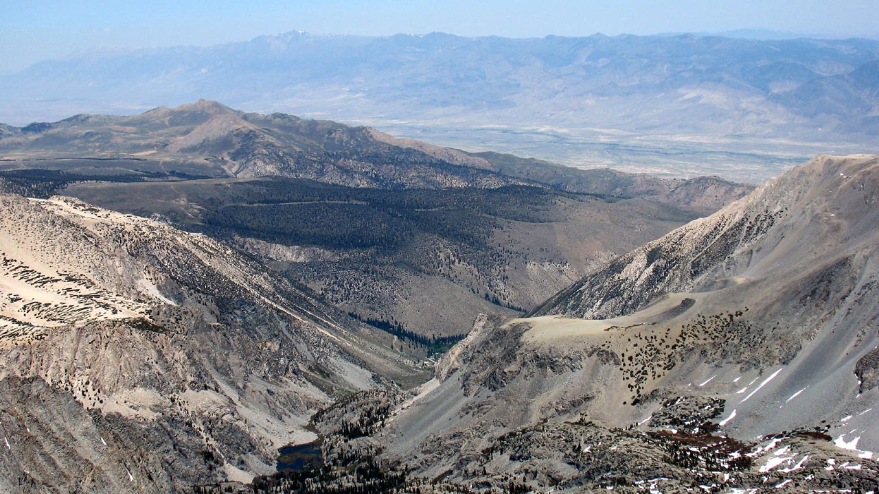 |
| View back down the route to the East and
Owen's Valley (Willow Lake, Glacier Lodge, Coyote
Flat and distant White Mountain) |
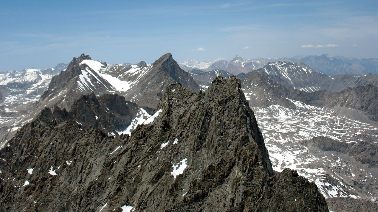 |
| North from the summit. Norman Clyde (used
to be Mt Constitution) (foreground). North
Palisade and Mt Sill (mid ground) |
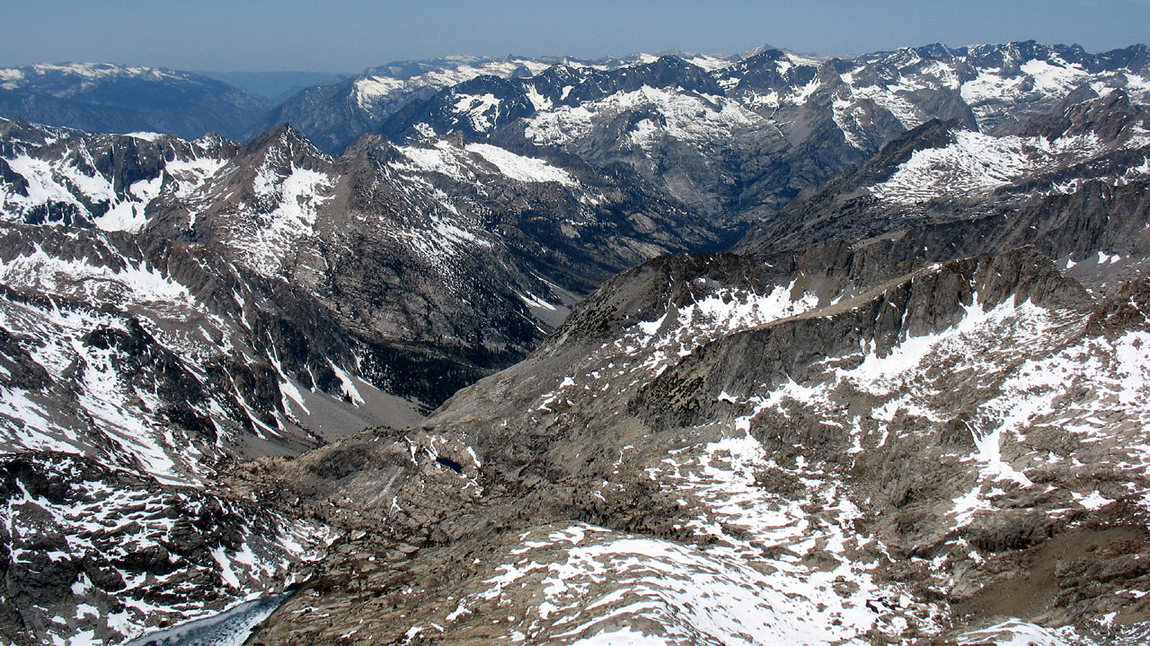 |
| West from the summit. Palisade
Lake, Palisade Creek and out the Middle Fork of the King's River. |
 |
| Middle Palisade & Norman Clyde from 1999
high camp while doing Mt Sill |
| |
| Back to map
to Map Back
to Mountaineer Back to Palisades |