| Back to map
to Map
Additional Mono Lake Tufa
(slide show) |
| Mono Lake |
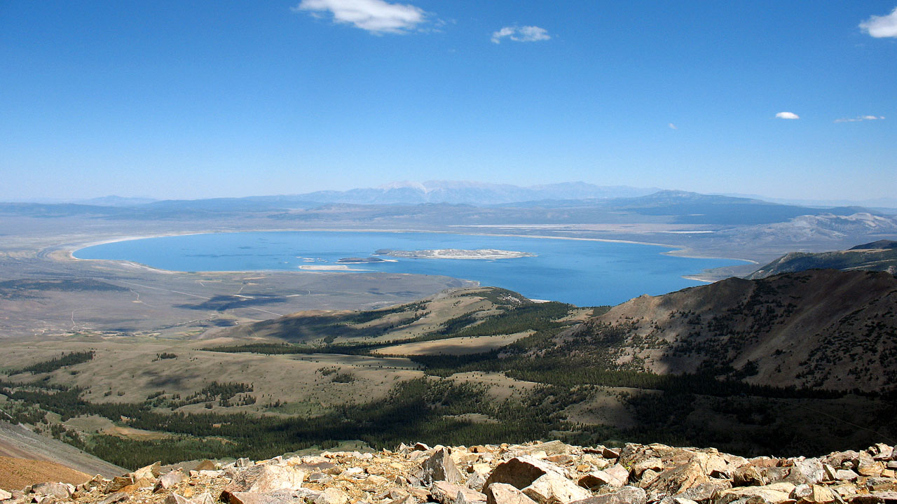 |
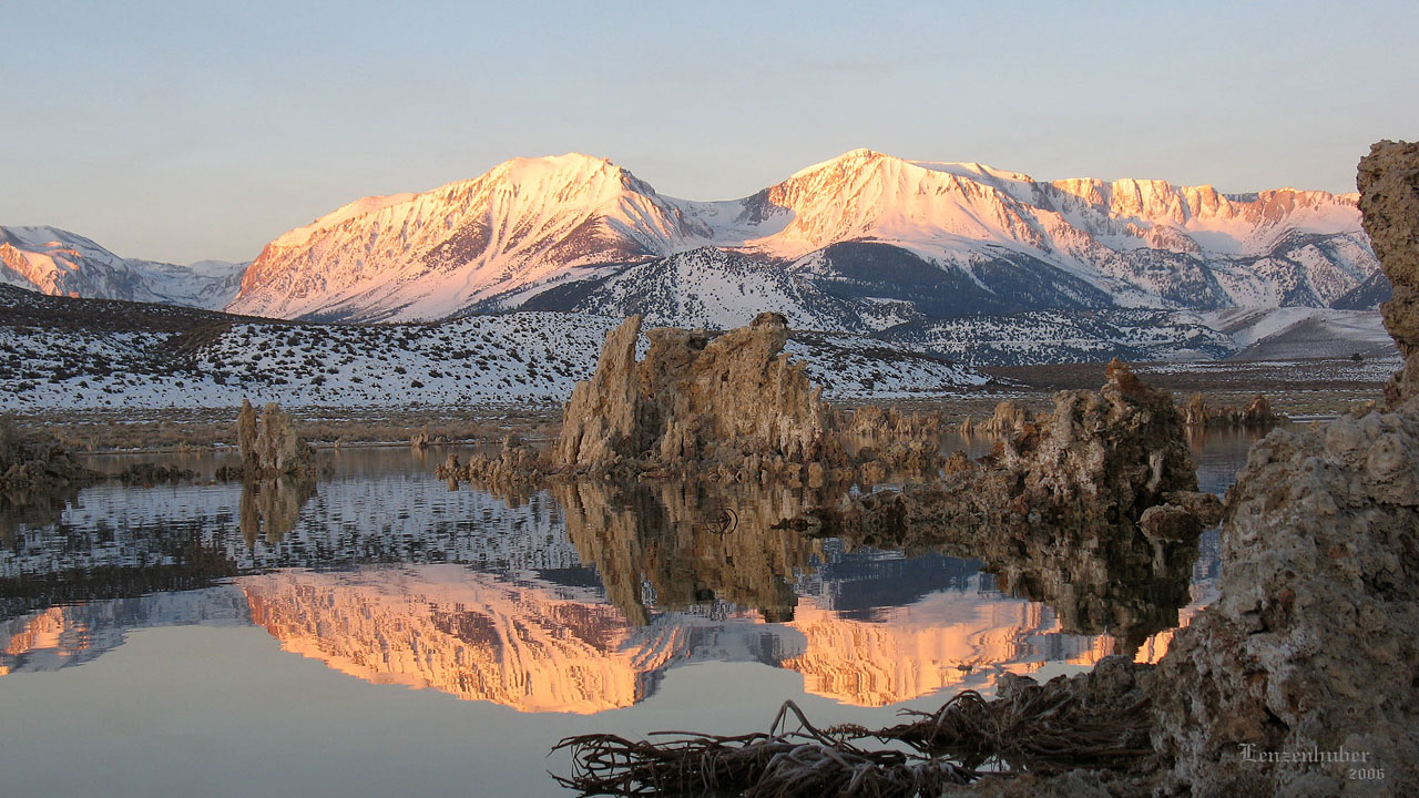
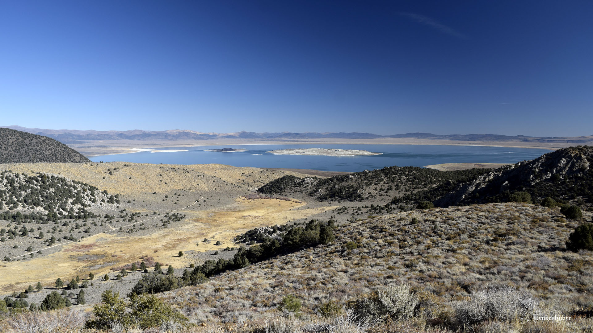
| Mono Lake from near the summit of Dunderberg
Peak (Distant White Mountains) |
| The Lake is at
least 760,000 years old (Some estimates 1-3 million),
the Mono Craters are less then 40,000 years yet the tufa has only been
exposed above water for less than 100 years. (When LA
started diverting water in 1941,lake elevation was 6417'). The
tufa formed from under water springs which slowly built up columns of calcium
carbonate from the lake floor. The Mono Craters are plugged volcanoes.
By 1981 the level was down over 45 feet, which had halved the volume of
the lake and doubled its salinity. LA was stopped before they drained
Mono Lake as they had done to Owen's Lake. The two Islands (Paoha and
Negit) are gull rookeries and LA was forced to keep enough water in the
lake to keep the islands from being connected to the shore, where
coyotes could get to the islands and the gull chicks. On September
28,1994 Los Angeles was mandated to allow the lake to refill to
6392' which is 25 feet below the 1941
level. |
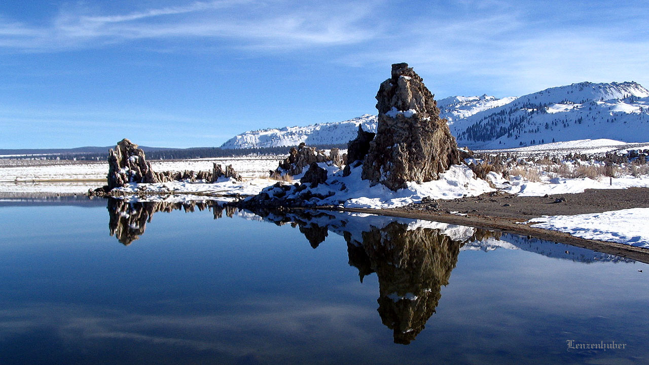 |
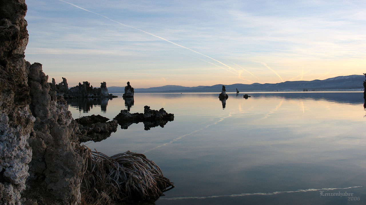
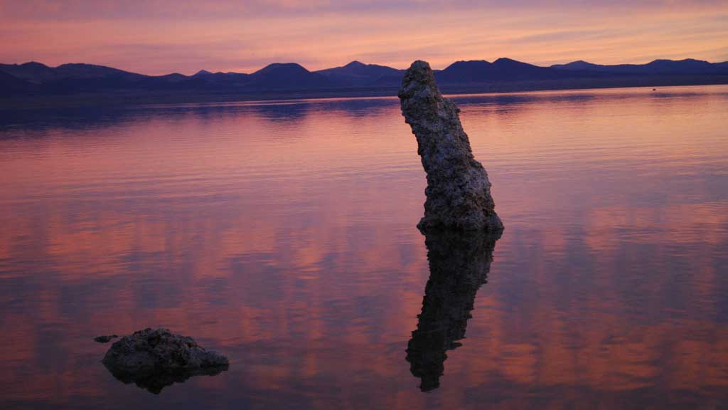
| Reflected Mono Lake tufa with
Inyo Craters in the back ground |
 |
 |
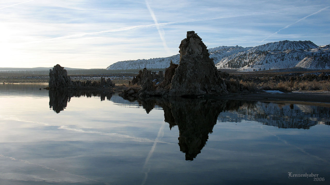
| Reflected Mono Lake tufa with the Inyo Craters
in the back ground |
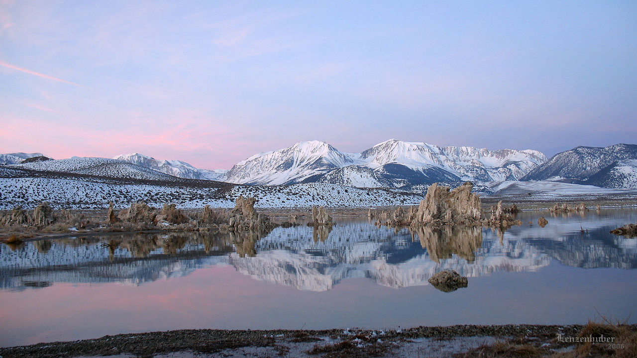
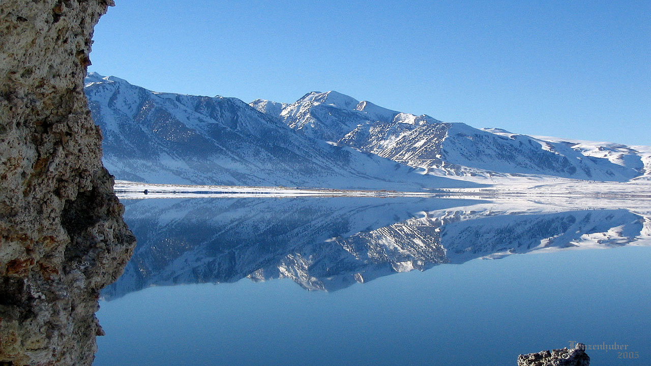
Tufa along with the Dana Plateau reflected
in Mono Lake |
| Mono Lake has no
outlet and evaporation and restricted inflow has made it much saltier
than the ocean (2 1/2 times saltier and 100 times more
alkaline), about the only thing that lives in it are bacteria, algae,
brine shrimp and alkali flies which are eaten by the birds. I prefer the
winter when the shores aren't black with alkali flies. Unfortunately the
area is extremely cold in the winter (Mono Lake/Lee
Vining and Bridgeport seem to be the coldest areas on US 395) |
 |
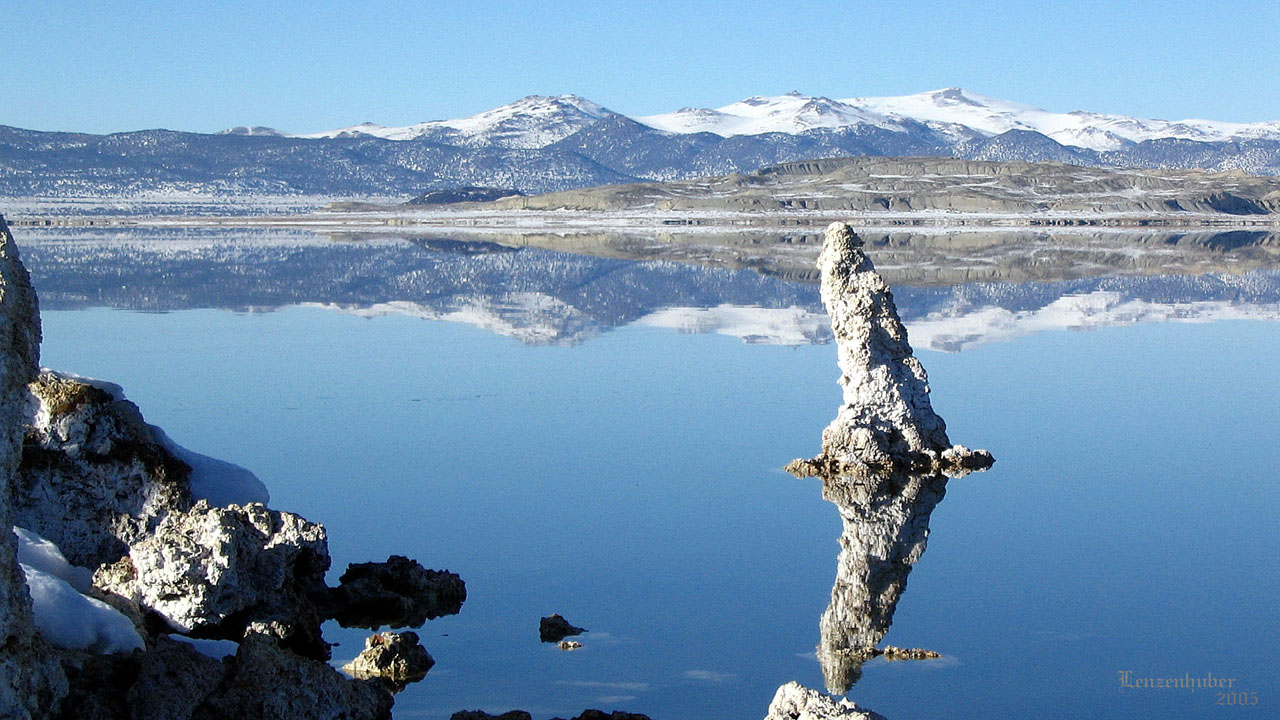
| Tufa along with the Mt Gibbs
and the Dana Plateau reflected
in Mono Lake |
 |
 |
| |
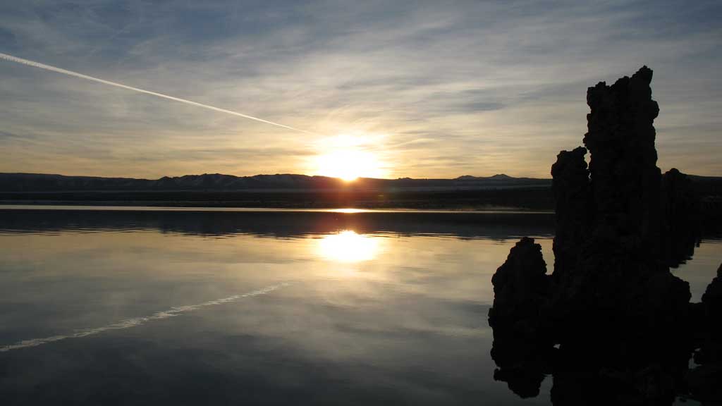 |
| Sunrise |
 |
 |
 |
 |
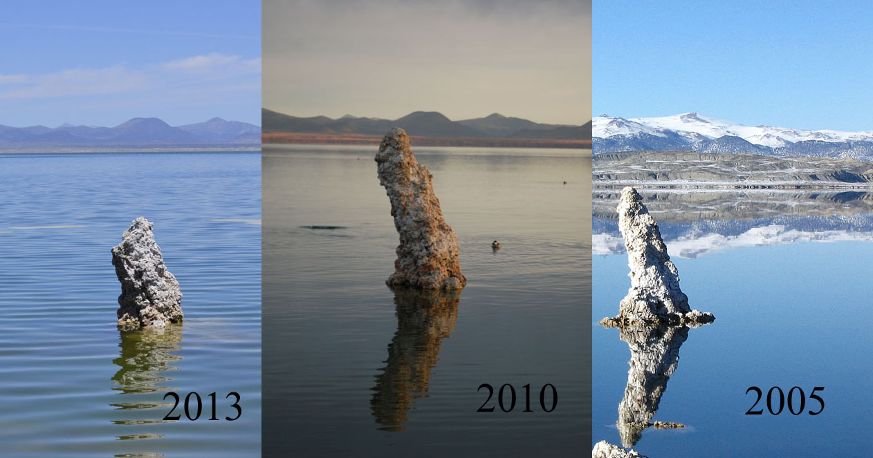
| Tufa formations |
Top 2005 - Bottom 2010 (the lake has
risen a few feet in 5 years) |
 |
| Lee Vining Canyon and the
start of the road to Tioga Pass and the east gate to Yosemite National
Park |
 |
 |
| Much of Bodie burned down, some is propped
up. Population was of over 10,000 by 1879 |
The old gold mill at Bodie is supposedly
open for tours now (was off limits for years) |
| The ghost town of Bodie
is on the northern side of Mono Lake, it can be reached from a dirt
road off Highway 167 which goes from Lundy Lake cutoff to Hawthorne
Nevada along the north side of the Lake or from a mostly paved road from
the north side of Conway summit before Bridgeport off US 395. A huge
gold discovery made Bodie rich and dangerous. The bad men of Bodie were
infamous. A young girl once wrote in her diary "Goodbye God you
wont be seeing me for a while we're moving to Bodie" Winters at
8375' were severe with snow occasionally up to second floor
windows. |
 |
 |
| Lake levels (The top of tufa formation in 2005
is about 4 feet above the water line) |
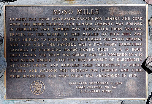
ECV plaque at Mono Mills site |
| On the southeastern side of
Mono Lake the largest continuous Jeffery Pine forest in the world was
logged, milled and the lumber shipped to Bodie by railroad. |
 |
| Mono Lake and Lower Horse Meadows |
| Back to map
to Map |